
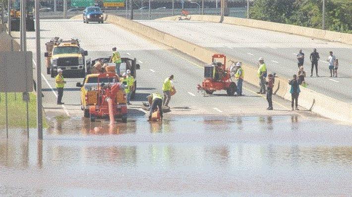
PHILADELPHIA (September 25, 2026) — A powerful nor'easter is churning off the Eastern Seaboard, bringing a prolonged, multi-day threat of rough surf, high winds, and significant coastal flooding to the Mid-Atlantic. While coastal communities brace for the brunt of the storm, the Philadelphia region is closely monitoring the system's track as it shapes the weekend forecast for the city and surrounding suburbs.
The storm is expected to heavily impact millions along the I-95 corridor through the weekend, with the most severe conditions concentrated along the Jersey Shore and Delaware beaches.
Coastal Chaos: Flooding and High Winds
For those heading east, weather experts are advising extreme caution. A combination of persistent northeast onshore winds and a full moon this Saturday is creating a perfect recipe for severe coastal flooding and beach erosion.
The National Weather Service has issued Coastal Flood Warnings, High Wind Warnings, and Wind Advisories for coastal counties. Forecasters anticipate:
- Fierce Winds: Northeast wind gusts of 35 to 50 mph, which will trap water in back bays and tidal waterways.
- Dangerous Surf: Breaking waves of 6 to 12 feet are expected to repeatedly pound the shoreline, accompanied by a high rip current risk extending through the weekend.
- Tidal Flooding: Because the onshore flow will continue for several days, water will struggle to drain between high-tide cycles, leading to multiple rounds of flooding that will peak between Friday and Saturday.
The Impact on Philadelphia
For Philadelphia and areas farther north and west, the storm's severity hinges entirely on its final weekend track. Meteorologists are watching two primary scenarios:
Scenario 1: An Offshore Track. If the coastal low continues moving northeast and remains comfortably out to sea, the Philadelphia region will dodge the worst of the system. Rain would remain concentrated near the shore, leaving the city with breezy conditions, cooler temperatures, and relatively limited inland impacts.
Scenario 2: The Northwest Hook. If the storm turns northwest back toward the Mid-Atlantic coast—a possibility suggested by some forecast models—the impacts on Philadelphia would be considerably greater. This track would push heavy rain much farther inland and bring stronger, longer-lasting wind gusts to the city and the broader Pennsylvania suburbs.
Regardless of the exact track of the rain bands, the city will not escape the storm entirely. A Coastal Flood Advisory is already in effect for the Philadelphia area, including the tidal Delaware River, as the storm pushes water up the bay.
Currently, the National Weather Service forecast for Philadelphia calls for breezy conditions and increasing cloud cover today, with rain likely developing by Saturday and continuing into Sunday.
Residents across the Delaware Valley are advised to secure loose outdoor objects due to the wind, monitor local tide cycles if living in flood-prone areas, and stay tuned to forecast updates as the storm makes its critical weekend pivot.