November 18, 2025 – As Pennsylvanians trade their light jackets for heavy coats, the question on everyone’s mind is simple: Will this winter actually feel like winter?
After a string of lackluster snow seasons, forecasters are buzzing with a different prediction for the winter of 2025-2026. A weak La Niña climate pattern has officially established itself in the Pacific, and unlike the "strong" events of the past, this weaker signal is opening the door for a more volatile, and potentially snowier, winter across the Commonwealth.
Here is a breakdown of how La Niña is expected to shape Pennsylvania’s weather from Pittsburgh to Philadelphia.
The Big Picture: The "Weak" La Niña Factor
Typically, a strong La Niña drives a warmer, wetter pattern for Pennsylvania, often pushing the storm track too far north for significant snow. However, meteorologists note that this year's La Niña is weak.
This distinction is critical. A weak La Niña doesn't dominate the atmosphere as forcefully, allowing other climate drivers—like the Polar Vortex and the North Atlantic Oscillation (NAO)—to take the wheel. This setup creates a "battleground" scenario for Pennsylvania, increasing the chances for cold air outbreaks to collide with moisture, a recipe that has been missing in recent years.
The Timeline: A Season of Mood Swings
Forecasters generally agree on a "sandwich" pattern for this winter:
-
December (The Cold Start): Prepare for an early chill. Unlike previous years where winter arrived late, December 2025 is trending colder than average. This setup significantly increases the odds of a White Christmas for central and northern PA, a festive sight that has become increasingly rare.
-
January (The Thaw): The classic La Niña "Southeast Ridge"—a dome of high pressure off the coast—is expected to flex its muscles in mid-winter. This will likely bring a "January Thaw," forcing temperatures up and introducing the dreaded wintry mix (rain/sleet) particularly for areas south of I-78.
-
February & March (The Wildcard Finish): As the La Niña weakens further heading into spring, the pattern may unlock again. Late February and early March are being flagged as prime windows for major coastal storms (Nor'easters). If the cold air holds, this is when the biggest snowfall totals could occur.
Regional Breakdown: Who Gets the Snow?
While the entire state should see more frozen precipitation than last year's record lows, the benefits will not be distributed equally.
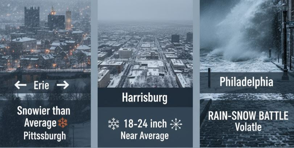
Western PA & The Alleghenies (Pittsburgh, Erie, State College)
-
Forecast: Snowier than Average.
-
The weak La Niña pattern often keeps the Great Lakes active. As cold air sweeps over the relatively warm lakes, lake-effect snow will be a frequent visitor for Erie and the snowbelt. Pittsburgh and the Laurel Highlands can expect frequent "clipper" systems—fast-moving storms that drop a quick 2-4 inches—keeping road crews busy throughout the season.
Central PA (Harrisburg, York, Lancaster)
-
Forecast: Near Average / "The Battle Zone."
-
This region is predicted to see a significant improvement over recent "snow droughts." Current projections suggest snowfall totals could land in the 18-24 inch range for the Harrisburg corridor, a healthy bump from recent years. The biggest risk here is the "mixing line"—storms that start as snow but change to rain or sleet during the January thaw.
Eastern PA (Philadelphia, Lehigh Valley)
-
Forecast: Volatile / Rain-Snow Battle.
-
For the I-95 corridor, the fight for snow will be tough but not impossible. The weak La Niña favors a storm track that cuts inland, which often draws warm ocean air into Philadelphia, turning snow to rain. However, because the La Niña is weak, it only takes one or two well-timed coastal storms colliding with cold air to produce a blockade-style snow event. Expect a winter of "close calls"—rainy washouts mixed with one or two potential heavy snow threats in late winter.
The Bottom Line
Pennsylvania is looking at a winter that feels more "traditional" than the torch-warm seasons of the recent past. It won't be an Ice Age, but it won't be a total washout either.
What to prepare for:
- A colder-than-normal December.
- Icy conditions during the January transition.
- A potentially active and stormy end to the season in February.
So, keep the shovels handy—unlike last year, you might actually need them.


